
Surveying expertise for development, construction, and property decisions across New Zealand.
ACE Surveyor is a director-led surveying practice based in Auckland, supporting homeowners, architects, builders, and developers across New Zealand.

Get in touch
021 198 7679
1A/25 Airborne Road, Rosedale, Auckland 0632
info@acesurveyor.com
Service Overview
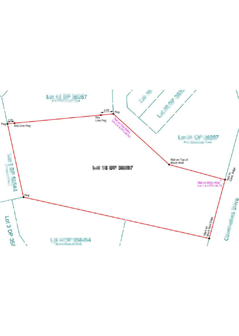
Re-establishment of property boundaries in accordance with Land Information New Zealand (LINZ) cadastral requirements.
Service Benefits
- Defines legal boundary positions to LINZ standards
- Helps avoid disputes and encroachments
- Supports fencing, retaining, and construction planning
- Provides evidence for council or lending requirements
- Identifies easements and title encumbrances
How we work
We research title evidence, locate existing survey marks, and complete field measurements. Boundaries are calculated, marked on site, and documented in a compliant plan.
Typical Deliverables
Boundary re-establishment plan
Boundary marks and offsets for construction
Notes on easements and encroachments
Survey records suitable for LINZ if required
FAQs
Yes, where accessible we place boundary pegs or offset marks to guide fencing and construction.
We use title and deposited plan data and can obtain these if you do not have them. Site access is also required.
Yes, if you need structures and setbacks shown, we can provide a combined detail and identification survey.